
If you find errors OR have additional information about this site, please send a message to contact@waynehistorians.org.
Change Bridge #39 and Historic Marker
| Historic Site #: | 06-039 (Exists) Type: B3,B4,I1 | Town: | Macedon | ||
| Site Name: | Change Bridge #39 and Historic Marker | GPS Coordinates: | 43.071777, -77.290057 | ||
| Address: | 1700 O'Neil Rd. Macedon NY | ||||
| Description: | |||||
| Enlarged Erie Canal Change Bridge No. 39, also known as Gallup's Bridge, is located just east of the Village of Macedon in Wayne County. | |||||
 |
 |
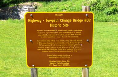
| Erie Canal web site.Historical marker at Enlarged Erie Canal Change Bridge no. 39 (Gallup's Bridge) just west of Lock 60. | Erie Canal web site. Google Earth views of Enlarged Erie Canal Change Bridge no. 39 (Gallup's Bridge) ; in the left view, the change bridge is on the left |
 |
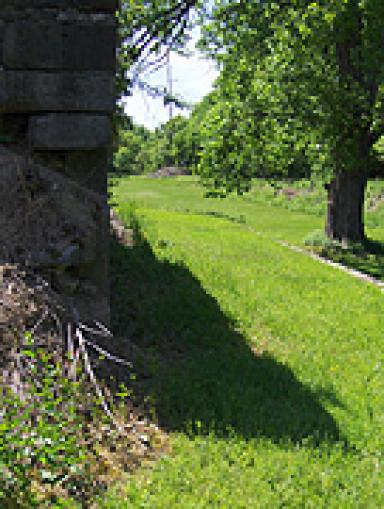 |
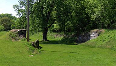
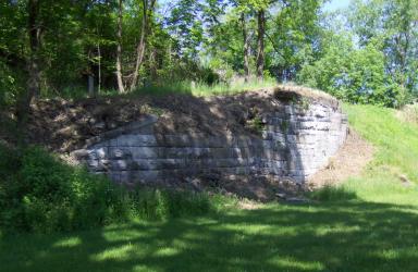
| Erie Canal web site. Remains of Enlarged Erie Canal Change Bridge no. 39, looking west. The towpath goes under the bridge just to the right of the south abutment. | Erie Canal web site. The towpath under the bridge, looking west from the base of the southern abutment |
 |
 |
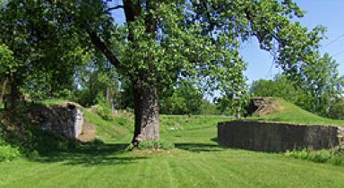
| Erie Canal web site. Looking east from within the canal prism. | Erie Canal web site. Looking north at the north abutment. |
| Historic narrative: | |||||
| The bridge allowed the towpath to switch from one side of the canal to the other during the Enlarged Erie Canal era (1840-1905). West of the bridge, the towpath was on the south side of the canal, and east of the bridge, the towpath was on the north side. The bridge served a dual purpose, being a highway bridge carrying the main highway between Macedon and Palmyra as well. The bridge was an iron lattice truss with a wood floor, and was built in 1881. For further details see the historical marker in the right-hand picture above. Mules towing boats going west would cross the bridge from the north side to the south side, and curl around to their left, passing under the bridge on the towpath just to the side of the south abutment.. | |||||
Erie Canal web site