
If you find errors OR have additional information about this site, please send a message to contact@waynehistorians.org.
Block House Road Historic Marker
| Historic Site #: | 03-078 (Exists) Type: B2,I0 | Town: | Galen | ||
| Site Name: | Block House Road Historic Marker | GPS Coordinates: | 43.079686, -76.868547 | ||
| Address: | 13 Water Street Clyde NY | ||||
| Description: | |||||
| This historic marker is located near the east end of Lauraville Landing park along the Canalway Trail. | |||||
 |
| Courtesy of Tom Sawtelle |
| Historic narrative: | |||||
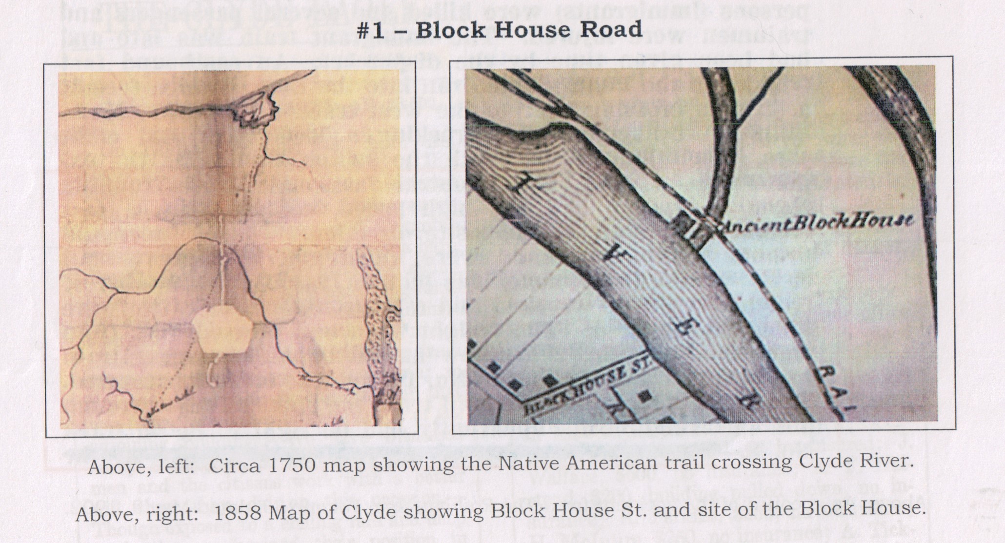
| Later called Block House Road, this important former Native American trail leading from Sodus Bay once crossed the Clyde River near this site. About 1858, the road took its name from an 18th century block house fortification that stood on the north side of the river. Travel on this north-south route through the Galen area was important for several reasons. Settlers and Native Americans were often heading toward Lake Ontario or the settlement at the site of Geneva, N.Y. then called Canadesaga. It was also an area that overlapped the territories of the Seneca and Cayuga nations. It was also attractive because of the Clyde Blockhouse. | |||||
William G. Pomeroy Foundation